The GHRSST is an open international science group that promotes the application of satellites for monitoring sea surface temperature (SST).
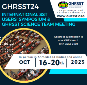
Our 24th International SST Users’ Symposium and Science Team Meeting will take place from 16-20 October 2023 in #Ahmedabad and online, hosted by ISRO – Indian Space Research Organization
![]()
Aim of the Symposium
The primary objective of this symposium is to foster discussion and collaboration among experts in the field and promote the utilization of satellite sea-surface temperature (#SST) data products for oceanographic research and applications.
Target audience
Researchers, scientists, students, and practitioners working with satellite sea-surface temperature, SST users, SST producers.
—————————————————————————————————————————————————
Symposium Science Sessions:
S1 – Science applications for Operational users of SST in India
S2 – Processing and product generation
S3 – Calibration, Validation and Product Assessment
S4 – Retrieval Algorithms
S5 – Novel Computing and Products
S6 – High-resolution future satellite missions
A description of the sessions is provided below.
Sessions’ descriptions
Science Session S1 – Science applications for Operational users of SST in India
Chair: T. Srinivas Kumar (INCOIS)
Co-chair: Neeraj Agarwal (ISRO)
Description of the session
Sea surface temperature displays variability over a wide range of space and time scales over the North Indian Ocean. The most pronounced oscillations in the SST are known to occur over the Bay of Bengal during the Indian summer monsoon season. Indian Ocean Dipole is another dominant mode of interannual variability in the tropical Indian Ocean that affects large-scale weather patterns. SST variability at the mesoscale and submesoscale plays a vital role in influencing air-sea interaction processes that modulate monsoons, tropical cyclone track and intensity, marine biodiversity, heat wave conditions etc., and this, in turn, affects the population in the Indian subcontinent. The Indian Ocean rim countries, accounting for one-third of the Earth’s human population, depend on the Indian Ocean (including the Bay of Bengal and the Arabian Sea) for food and resources and are significantly impacted by its variability. Hence, increasing our understanding of sea surface temperature variations at various spatiotemporal scales is extremely important.
In this session, the goal is to understand the requirements of SST for operational use in India. Speakers are invited to sensitize the GHRSST community about the various SST-based operational applications in India. The session will mainly discuss the spatiotemporal requirements and error tolerance in SST for these applications. The presenters should highlight the challenges existing GHRSST products pose while in use for applications like Numerical weather prediction and data assimilation, fine-scale features and thermal front detection, coastal processes, marine heat waves, cyclone track forecasting, tropical cyclone heat potential, marine ecosystem studies and many more. Another beneficial point of discussion would be whether the rapid sensing of SST through a constellation of satellites or by using a geostationary platform helps in resolving fine-scale features and whether the diurnal variations are crucial for any application. Sensor definition studies for SST observations, evaluation of different SST products for applications, and gap areas in existing observations are vital topics that can be addressed.
Keywords: thermal fronts, eddies, heat waves, air-sea interactions, potential fishing zones, Indian Ocean Dipole, Indian summer monsoon
Science Session S2 – Processing and product generation
Chair: Cristina Gonzalez-Haro (ICM, BEC)
Co-chair: Pallavi Govekar (BoM)
Description of the session
SST products, following the GHRSST Data Specification (https://zenodo.org/record/6984989), rely on data from low-Earth orbit infrared and microwave satellite imagery, geostationary orbit infrared satellite imagery, and in-situ data from moored and drifting buoys, Argo floats, and Fiducial Reference Measurements (FRM) for product validation. The products comprise a suite of global high-resolution SST products to support operational forecast systems, climate science, and many diverse applications, and to facilitate a wide range of research in the broader scientific community.
Additional user-driven priorities in the coming year have been identified to be in relation to the Arctic, where Sea Ice Surface Temperature needs to be homogenised with SST as a uniform variable in order to define the boundaries between ocean/sea-ice and land and where the existing Arctic SST/IST analyses need to be connected with the global L4 SST counterparts.
In this session, the goal is to provide a review of state of art processing SST algorithms at different levels (L2, L3, L4) and improvements developed (e.g., cloud masking, noise reduction, application of different new-merged techniques like machine learning…) using satellite and in-situ data. We also welcome discussion on generating ice and lake surface temperature products and downstream products to cater for biologists and ocean modelling communities such as reef-specific products, marine heat wave monitoring matrices, current and front detection and long-term time series of SST.
Gap-free SST L4 analysis using satellite, and possibly in situ data, are the most widely used SST products for both operational and research applications. Comparison and validation of the different analyses are welcome, in order to provide information to producers to enable them to improve their analysis systems and to provide users in their particular applications.
Keywords: SST algorithms, cloud masking, SST L4 intercomparison, SST Feature resolution, near-coastal applications,machine learning, user scientific applications.
Science Session S3 – Calibration, Validation and Product Assessment
Chair: Mingkun Liu (OUC)
Co-chair: Prasanjit Dash (NOAA)
Description of the session
This session aims to highlight recent advancements in sea-surface temperature (SST), with a particular focus on the calibration and validation of satellite-derived SST products and the assessment of their quality and applicability.
The session will focus on the following:
- Calibration and inter-calibration of satellite instruments.
- Validation of satellite-derived SST products.
- Comparisons between satellite data products and in situ measurements.
- Inter-comparisons of satellite data products from various platforms and sensors.
- Quality control and quality assurance of satellite data products.
- Evaluation of uncertainties and error sources in SST products.
Keywords: calibration, intercalibration, validation, product assessment, inter-comparison, quality control, quality assurance, uncertainties, evaluation, error sources.
Science Session S4 – Retrieval Algorithms
Chair: Pradeep Thapliyal (ISRO)
Co-chair: Rishi Kumar Gangwar (ISRO)
Description of the session
Sea surface temperature (SST) plays a key role in the monitoring and prediction of the ocean and weather processes, apart from being an excellent indicator for climate change. These weather and climate observations require accurate estimates of SST that are also consistent over a long period of time. Satellite-based infrared and microwave instruments have been providing valuable information for SST at a global scale, apart from conventional SST measurements from Buoys and other oceanic platforms. However, estimation of the SST from satellite based IR and MW instruments are indirect in nature and are affected significantly due to the presence of water vapor, cloud and aerosols as well as uncertainties in spectral surface emissivity. This requires development of advanced techniques for retrieval and atmospheric correction through improved radiative transfer models and numerical techniques.
In this session, the goal is to discuss the recent developments in the retrieval algorithm including techniques for cloud mask, atmospheric correction due to water vapor as well as aerosol. Special emphasis will be on recent advances in the field of AI/ML techniques for retrieval algorithm as well as cloud detection and atmospheric correction.
Contributions in the following broad areas are highly anticipated:
- Development of physical and AI/ML based algorithms.
- Optimal Estimation and bias-aware optimal estimation.
- System definition studies for new instruments for SST estimation.
- Synergy of IR/MW observations towards improved merged SST products.
- Algorithms for generating climate quality SST products.
- Improved techniques for regional bias correction.
- Modelling differences of skin SST to SST depth.
- Demonstration of high resolution coastal SST products.
- Synergy of GEO/LEO for studying diurnal variability in SST.
Keywords: SST, Physical retrieval, AI/ML techniques, Cloud Mask, Climate quality, IR Radiometers, MW Radiometers, optimal estimation.
Science Session S5 – Computing and Products
Chair: Edward Armstrong (NASA/JPL)
Co-chair: Nitant Dube (ISRO)
Description of the session
In the recent year, several satellite SST products have become available to users. The number of GHRSST- formatted data sets is more than 100 and the data volumes have increased significantly, calling for new ways of formatting and analyzing the data sets.
In this session, the goal is to present new SST products to the SST users and producers community. The products can include both level 2, 3 and level 4 products. Improvements to existing products can also be presented in this session, together with new ways of analyzing the vast amount of satellite data that are available.
These new approaches can include the usage of cloud computing resources or the formatting of existing satellite products, to facilitate the analysis.
In this session contributions are encouraged on:
- New satellite SST products or improvements to existing data sets.
- Examples of the usage and assimilation of SST products.
- Innovative ways of analyzing large amounts of data.
- Use of cloud computing for analyzing the data sets.
Keywords: New satellite SST products, cloud computing, analysis ready data, Innovative analysis methods.
Science Session S6 – High-resolution future satellite missions
Chairs: Philippe Gamet (CNES) and Emmanuelle Autret (IFREMER), Co-chair: Bimal Bhattacharya (ISRO)
Description of the session
Over the next few years, several new satellites are planned to be launched, including infrared and microwave instruments in polar and geostationary orbits. The high spatial resolution of SST will continue to be maintained and improved including those with very high-resolution SST observations less than 100 meters. New evolutions, including the introduction of very high spatial resolution missions, will provide new opportunities for applications but will also require developments within retrievals, validations and cloud masking. It is therefore important that the new developments within high resolution SST products are coordinated with the ongoing international SST activities.
Many global ocean SST users are requesting improved SST products near to and at the coastal zones, products with improved feature resolution including at frontal zones, and improved consistency of products at high-latitudes and at the marginal ice zone. At the recent GHRSST science team meeting, it was therefore concluded that the coordination of high-resolution SST science would be a priority for the coming years.
In this session, the goal is to focus on the following:
- Overview of the future high resolution thermal infrared missions for coastal and inland waters SST (TRISHNA, LSTM, SBG, …).
- Towards new data products combining high-resolution water color variables and SST.
- Improving continuous monitoring of SST with future high resolution thermal infrared missions: issues and challenges.
- How to enhance synergies between future missions for data processing, reprocessing, archival, dissemination, and utilization.
- On-orbit cross-calibration of thermal infrared instruments.
- Assess GHRSST contribution to the future missions (gathering user’s needs, expertise on the SST retrieval algorithms, validation of the products).
Keywords: future missions, high resolution thermal infrared missions, synergies between future missions, cross-calibration, future, coordination