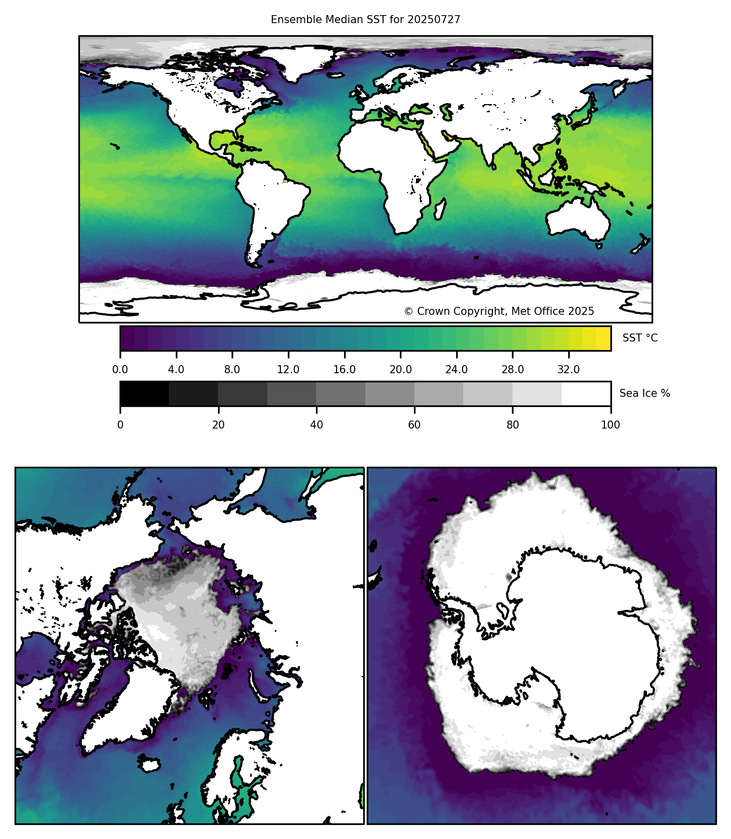
Latest Multi-Product Ensemble (GMPE) median:
#YourdailysatelliteSSTmap:
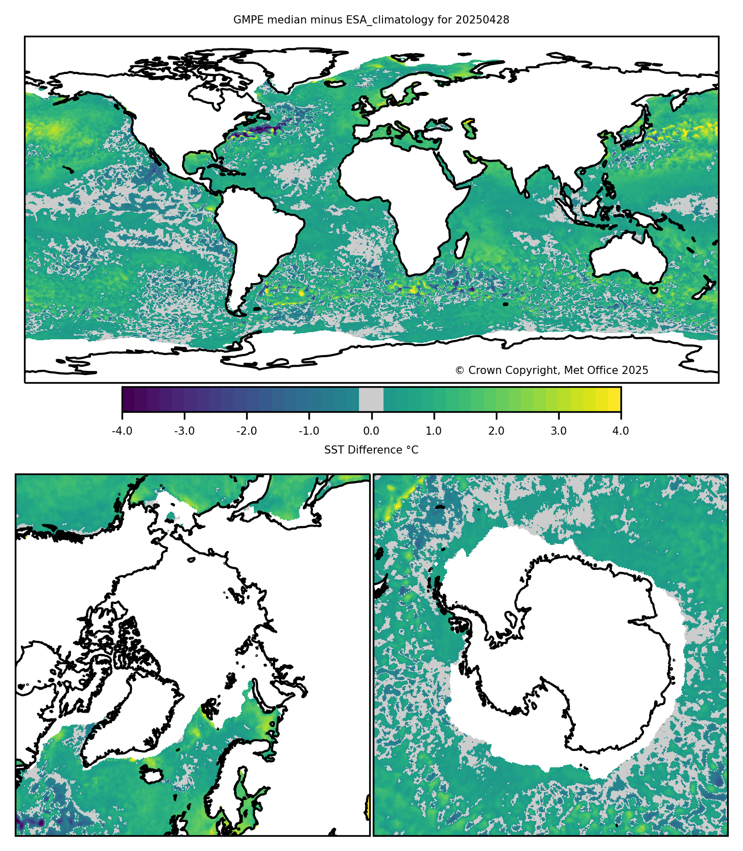
- Click here for the anomaly map (difference to climatology) and
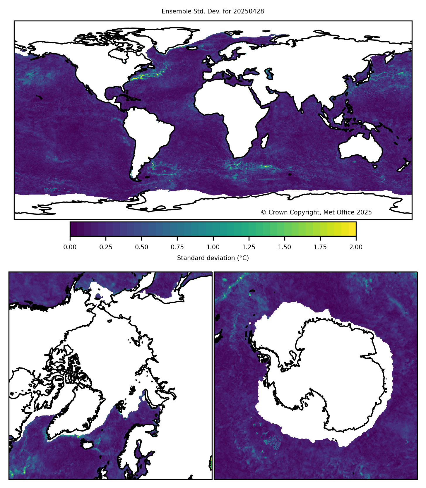
- Click here for the the spread in the ensembles.
GHRSST Multi-Product Ensemble (GMPE)
Each day the GHRSST Multi-product Ensemble ( GMPE ) experiment, coordinated by the GHRSST Inter-Calibration TAG (IC-TAG), produces a median SST map and associated standard deviation map using SST analysis data collected over the last 24 hour period (i.e. yesterday). Thus, the nominal analysis time for the GMPE median ensemble SST is 12:00Z for the previous day (i.e., T-1). The image data sets are updated each day ~13:30Z.
The GMPE median ensemble SST map (click here) is computed as a median average using a variety of GHRSST L4 analysis products after their differing analysis grids have been homogenised by area averaging onto a standard 0.5° lat/lon grid. Although several analyses provide greater coverage (such as large lakes) the median-ensemble SST coverage is restricted by the use of the OSTIA analysis land mask. The GMPE median ensemble SST is currently derived using the following inputs:
- Met Office OSTIA SST analysis
- NAVOCEANO NAVO K10 SST observations
- JMA MGDSST SST analysis
- RSS RSS MW Fusion SST analysis
- RSS RSS MW+IR Fusion SST analysis
- FNMOC GHRSST-PP SST and sea Ice analysis
- ABoM GAMSSA SST analysis
- DMI OI SST analysis
- JPL MUR SST analysis
- OSPO Blended Night SST analysis
- CMC 0.1 degree SST analysis
NOTE: For the GMPE Median-SST product, where an input analysis product indicates sea ice but provides no SST value, a default value of -1.8°C has been substituted.
The associated standard deviation map provides the standard deviation of all input data sets for each grid square used in the median ensemble SST map.
The GMPE ensemble SST anomaly map is derived from NCEP/NOAA (Reynolds) OIv2. This climatology was formed from the weekly SST analysis performed by Reynolds et al. The climatology for the current week was computed from a daily climatology, which in turn was computed using an average of all weeks between 1985 and 2001 containing that day of the year. The analysis resolution is 1 degree spatially. More detail can be found on the NOAA Optimum Interpolation home page
More information and a complete anomaly comparison for each input data set (input analysis minus GMPE median ensemble) is available at
http://ghrsst-pp.metoffice.gov.uk/ostia-website/gmpe-monitoring.html