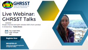
Tuesday 4 April 2023
Time:
From 5.00 pm-5.45 pm CEST
From 3.00 pm-3.45 pm UTC
(check your timezone https://www.worldtimebuddy.com)
Single Channel SST from Landsat in Antarctica
New applications of thermal infrared imagery in Antarctic glacier-ocean systems using open cloud-computing workflows
Landsat recently released its Collection 2 Level 2 Surface Temperature product, marking the first comprehensive calculations of surface temperatures from the four-decade-long Landsat mission sequence. Producing surface temperatures requires complex integration of Landsat imagery with external atmospheric datasets and model outputs, to compensate for the lack of dual thermal bands (Landsat 4/5/7) and other bands required for atmospheric correction (Landsat 4/5/7/8/9). Although this work provides a reliable surface temperature product, gaps still exist for sea surface temperature (SST) retrievals: the algorithm is optimised for acquiring land surface temperatures (i.e., not SST), and surface temperatures are not produced at night or around Antarctica.
Here, we develop Landsat single-channel and split-window SST algorithms that will allow for integration with GHRSST products and will also be developed as an on-demand, cloud-based, user-customizable data product. The single channel algorithm uses coincident atmospheric profiles from reanalysis data for temperature, relative humidity, and geopotential height as inputs into a radiative transfer model to account for the atmospheric effects on thermal retrievals. The Non-Linear SST algorithm for split-window Landsat data (Landsat 8/9) will use the Canadian Meteorological Center Global Foundation SST product as a SST reference, and radiative transfer model-based simulations of at-sensor brightness temperatures to derive the algorithm coefficients. Our cloud-based workflow—modelled after the ICESat-2 SlideRule project—will provide a framework for on-demand data product generation and serving, allowing users to specify algorithms and atmospheric data inputs and models to retrieve Landsat SSTs optimised for their scientific needs.
Speaker’s profile
Tasha Snow received her MSc in 2014 from the University of South Florida and her PhD in 2019 from the University of Colorado Boulder. Tasha’s work focuses on how oceans interact with glaciers in Greenland and Antarctica, and she is developing new ways to apply satellite thermal infrared imagery to study these systems. She specializes in remote sensing, machine learning, cloud computing, and open-source science. One of her most exciting projects at the moment is leading the CryoCloud cloud-computing project (cryointhecloud.com) to help usher NASA Cryosphere communities into the cloud and to help build open-source science infrastructure and community best practices.
Recording of the talk
