Session Description
This session is dedicated to challenging regions for SST retrieval and analysis, with particular focus on coastal regions and the Arctic, which has been recognized as a user-driven priority for the upcoming year. Coastal regions are challenging due to proximity to land, turbidity, tidal motion / mixing, upwelling or high gradients. In the Arctic, challenges arise due to a persistent cloud cover and the mix of open water and sea ice (and the temporally varying sea ice cover). Recent efforts have been made to get Sea Ice Surface Temperature (IST) homogenised with SST as an uniform variable (X-ECV) in order to define the boundaries between ocean/sea-ice, and there is a growing need to get these connected with the global L4 SST counterparts. Both the coastal and Arctic regions are lacking satellite and in situ observations, which limits the possibilities for algorithm training and/or validation purposes. Improved SST coverage and accuracy in the coastal regions will benefit the forecast performance of operational ocean models. Ocean forecasting will also benefit from improvements in satellite SST cloud clearing algorithms to preserve cool ocean features, such as coastal upwelling.
The goal of this session is to provide an overview of satellite and in-situ data available for these challenging regions and provide examples on how these data are used for monitoring and/or ocean applications.
The session will focus on the following:
- Advances in SST retrievals, in situ observations and products for challenging regions
- Applications of SST observations in regional assessments of climate change and variability in challenging regions
- Comparison and validation of SST products in challenging regions
- Advances in the representation of the marginal ice zone SST and combined SST/IST estimates
Keywords: Coastal regions, Arctic, sea ice, remote areas, boundaries, X-ECVs
Keynote
Multi-scale variations of ocean temperature off the coast of Nova Scotia: Analyses in situ and remote sensing observations and high-resolution ocean models towards applications in ecosystem and fishery
Youyu Lu, Fisheries and Oceans Canada
Since 2002, Dr. Lu has been a Research Scientist with Fisheries and Oceans Canada (DFO), at Bedford Institute of Oceanography, Dartmouth, Nova Scotia.
He obtained a PhD degree in 1997 from University of Victoria, Canada.
His research covers broad aspects of physical oceanography (ocean circulation, sea levels, hydrography, sea-ice, etc.), and their influences on marine ecosystem and environment. His study areas include the deep ocean from tropics to Arctic, shelf and coastal seas, and lakes. He has published 95 refereed articles, supervised about 20 young scholars and co-supervised 10 graduate students at master and PhD levels, and been PI or co-PI of about 20 research projects.

Talks
Evolution of Copernicus Marine Surface Temperature Products in Coastal Regions and High Latitudes
Gary Corlett, EUMETSAT
Gary is a remote sensing scientist at EUMETSAT specialising in SST retrieval and validation from the Copernicus SLSTR and has 25-years’ experience in remote sensing of both the Earth’s atmosphere and surface. His current research interests are related to comparing satellite derived SST to in situ measurements over long time scales and understating the uncertainties throughout the process. Prior to joining EUMETSAT in 2018 he was a research fellow in Earth Observation at the University of Leicester and Director of the GHRSST International Project Office.

SST trends and extreme events across L4 SST datasets at 23 globally significant coastal habitats for top marine predators
Marisol García-Reyes, Farallon Institute
Marisol has a Ph.D. in atmospheric sciences, but she’s an oceanographer at heart. She has studied coastal upwelling for over 15 years, focusing on its variability, how it relates to climate, and how it shapes the marine ecosystem. At Farallon Institute, in California, her current research focuses in how climate change, variability, and extreme events impact marine habitats in Eastern Boundary Upwelling Systems and in the Subarctic and Arctic Pacific, and how remote sensing ocean data perform in these challenging regions. Marisol has been a mentor for over 10 years, committed to increasing diversity in education and sciences.

Using satellite-derived surface temperatures to benchmark climate models and reanalyses in the Arctic
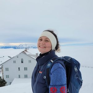
Pia Englyst, DMI
Pia Englyst is a researcher at the Danish Meteorological Institute and has a background in physics and remote sensing. She obtained her PhD in 2023 from the Technical University of Denmark on sea and sea-ice surface tempertures from satellites. Her expertise lies within SST retrievals (mainly from microwave observations) and in the generation of L4 products of SST and sea ice surface temperatures. An important aspect of her work involves validating, analyzing (climate trends etc.) and supporting applications of the satellite derived products e.g. model evaluation and benchmarking.
Status of the Ice and Sea Surface Temperature activities at MET Norway and DMI
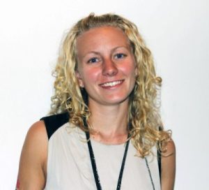
Steinar Eastwood, MET Norway
Steinar’s main interests are in retrieval of sea and ice surface temperature at high latitutdes, as well as sea ice characteristics. This also includes climate consistent time series.

Posters
Validation and Algorithm Development of R2019 MODIS-derived Sea Surface Temperature at High Latitudes
Chong Jia, Rosenstiel School of Marine, Atmospheric, and Earth Science, University of Miami
Chong Jia is Ph.D. student in Meteorology and Physical Oceanography at the Rosenstiel School of Marine, Atmospheric and Earth Science, University of Miami. Chong holds a Bachelor of Science from Ocean University of China and a Master of Science from the Rosenstiel School of Marine, Atmospheric and Earth Science, Univeristy of Miami. His professional background centres around physical oceanography, satellite remote sensing and air-sea interaction. Chong’s expertise and research interests lie within satellite SST retrievals (error budget analysis, algorithm improvement) at high latitudes, ocean skin effect and diurnal warming studies at high latitudes. Chong is currently participating in the Multi-sensor Improved Sea-Surface Temperature (MISST) project and using the SST and other meteorological data from Saildrone vehicles to study the upper ocean thermal stratifications and validate the satellite SST retrievals at high latitudes.

Validation and Application of Satellite Derived Sea Surface Temperature Gradients in the Bering Strait and Bering Sea
Jorge Vazquez, Jet Propulsion Laboratory/California Institute of Technology
Dr. Jorge Vazquez is a Research Scientist at NASA Jet Propulsion Laboratory/California Institute of Technology where he is part of the Project Science Team for the Physical Oceanography Distributed Active Archive Center (PO.DAAC). He holds a Bachelor of Science in Physics form the University of Miami, Master of Science in Physical Oceanography from the University of Rhode Island, and a PhD in Geological Sciences from the University of Southern California. As a post-doc, Dr. Jorge Vazquez recounts his experience as a visiting scientist at the Institute of Marine Science in Barcelona, Spain as a time where many doors were opened up to collaboration with his Spanish colleagues, which have continued up to this day. Professionally, Dr. Jorge Vazquez has a background as a research scientist focusing on the application of Remote Sensing in Earth Science. His research interest and expertise fall within the application of Remote Sensing to Coastal Regions and the Arctic.
Read all about Dr. Jorge Vazquez’s professional experience, research interests, awards and more here: JPL Science: Jorge Vazquez (nasa.gov)

New observational thermal stress and marine heatwave monitoring tools for the Australian coasts
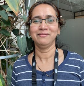
Pallavi Govekar, Bureau of Meteorology
Pallavi Govekar currently works as a research scientist in the Science and Innovation section of Bureau of Meteorology. Pallavi does research in Oceanography, Climatology and Meteorology. Her current project is ‘IMOS SST’ where she works on research and development of new satellite derived Sea Surface Temperature products of benefit to numerical weather prediction, seasonal forecasting and ocean forecasting. Pallavi’s work is focused on helping the modelling community to better understand surface conditions and developing and delivering downstream applications for marine and coastal industry.
Developing surface temperature retrievals for CIMR
Jacob L. Høyer, DMI
Jacob has worked with retrieval and validation of SST observations as well as the application in physical models. He has developed a multiplatform Optimal Interpolation scheme to provide accurate and high resolution interpolated global SST fields. Recently, he has worked with the validation and assessment of the high latitude satellite SST observations in the Arctic open ocean, in the marginal ice zone as well as sea ice surface temperatures observed from satellite.

Improving Copernicus L4 SST regional products with CIMR observations
Mattia Sabatini, CNR-ISMAR
Mattia has a master degree in physics and is currently a doctoral student at the University of Naples “Parthenope”. Mattia carries out his research activity at the Marine Sciences Institute of the National Research Council (CNR-ISMAR) in Rome. His main research interest is SST retrieval from future satellite missions.

A satellite-data-driven coastal awareness framework: CEOS COAST Application Knowledge Hub (AKH)
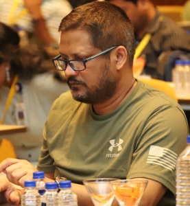
Prasanjit Dash, NOAA NESDIS STAR SOCD / Colorado State University CIRA
Prasanjit Dash has 20+ years of experience in terrestrial infrared satellite applications. He has contributed to space-based projects across the USA, Europe, and India. Since 2006, Dash has been with NOAA/NESDIS and the Cooperative Institute for Research in the Atmosphere (CIRA) at Colorado State University (CSU). He also had an interim association with EUMETSAT from mid-2016 to end-2017. Dash holds a PhD in Physics from KIT (Germany, 2004), an MTech from IIT-Kanpur (India, 1999), and an MBA from CSU (USA, 2017). He is a CIRA Research Scientist III and the site area manager for the CIRA NESDIS Environmental Application Team.
Saildrone Arctic field campaign and dataset, 2019-2022
Marisol Garcia-Reyes, Farallon Institute
Marisol has a Ph.D. in atmospheric sciences, but she’s an oceanographer at heart. She has studied coastal upwelling for over 15 years, focusing on its variability, how it relates to climate, and how it shapes the marine ecosystem. At Farallon Institute, in California, her current research focuses in how climate change, variability, and extreme events impact marine habitats in Eastern Boundary Upwelling Systems and in the Subarctic and Arctic Pacific, and how remote sensing ocean data perform in these challenging regions. Marisol has been a mentor for over 10 years, committed to increasing diversity in education and sciences.

A new global multi-source sea ice concentration composite
Ida Olsen, DMI
My name is Ida Olsen and I am a researcher at the Danish Meteorological Institute’s National Center for Climate Research, where I work in the Satellites and Arctic unit. I graduated last year from the Technical University of Denmark, with a specialization in Earth Observation. During my studies, I mainly worked with sea ice, including estimation of snow depth on sea ice, sea ice thickness and sea ice concentration, but after starting at the Danish Meteorological Institute, my research has shifted towards working with sea and ice surface temperatures.
