Background image source: EUMETSAT
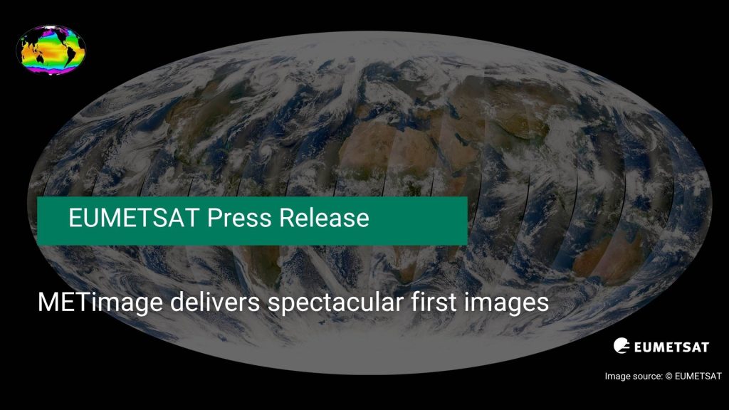
EUMETSAT has released the first Earth images from its METimage instrument on board the recently launched Metop Second Generation A1 (Metop-SGA1) satellite
These first images showcase “the exquisite detail, true-to-life colour and data products that will ultimately support national weather services in improving forecasts that save lives, protect communities and benefit economies”.
As can be read in the recent press release, published by EUMETSAT on 7th October 2025:
“Captured on 24 September 2025, METimage’s first scene spans Europe and North Africa, revealing intricate cloud structures linked to a cold front over central Europe, storm activity building over the Adriatic and central Mediterranean, and – under clear skies – vivid surface features such as the forests of the Carpathian and Balkan mountains, glistening lakes in Türkiye, and stark contrasts between North Africa’s deserts and greener terrain.
Subsequent pictures from the instruments first global sweep of images include dramatic views of Hurricane Humberto over the Atlantic and Tropical Storm Neoguri over the Pacific, vivid shifts in ocean colour from stirred sediments and bright sands in the Caribbean and off Australia, fog blanketing the US Great Lakes, and a cloud-free panorama of Asia with the Himalayas detailed down to individual snow-filled valleys.
Travelling around 830 kilometres above Earth in a polar, sun-synchronous orbit on Metop-SGA1, METimage is a new multi-spectral radiometer that provides near-global daily coverage. It observes in 20 visible-to-infrared channels at 500-metre resolution at nadir and with far sharper detail than its predecessor, the Advanced Very High Resolution Radiometer (AVHRR) on first-generation Metop satellites, which has a one-kilometre resolution at nadir. This capability supports precise observations of clouds, water vapour and aerosols, land and ocean surface temperatures, ice cover, vegetation and even active fires.”
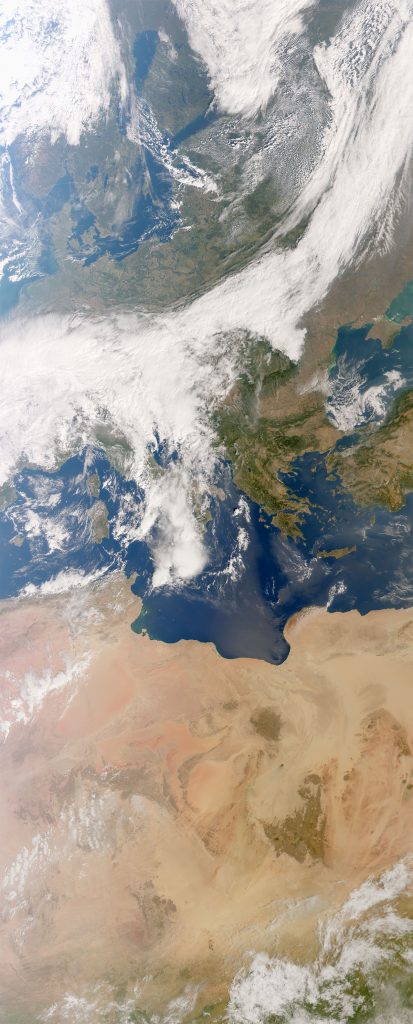
Image source: EUMETSAT
“Captured between 10:43 and 10:59 CEST on 24 September, METimage’s very first image shows clouds connected with a cold weather front sweeping across central Europe and signs of convective storm activity developing over the Adriatic and central Mediterranean seas. High altitude, wispy cirrus clouds hint to potential turbulence over the Netherlands, Belgium and Luxembourg, while thin aircraft contrails are clearly visible over cloud-free western Denmark.”
The full press release showcases many more incredible images, including composite images created by combining data from different spectral channels observed by METimage, early versions of METimage’s processed data products, and spectacular details of hurricanes and mountain regions.
Read the full press-release through the link below: